A blog about things that interest me, politics, news, media, architecture, development, environment, local history, secularism, web, dublin ireland, tara

Contact me at expectationlost@gmail.com
Showing posts with label gormley. Show all posts

Thursday, 17 July 2008

Antony Gormley Sculpture for Dublin Docklands permitted

The Antony Gormley Sculpture for the Dublin docklands has been giving permission by the Dublin City Council as noted in the Sunday Times.

The Dublin docklands has jumped on the big name fad but I think Gormley work like the Blind Light installation (where you can't tell the difference between people and sculpture among the smoke) and the pieces like the Quantum Cloud are exceptional and you can seen the engineering and craftwork much easier then in something like the bland Spire.

I like his description of it as a ‘like a charcoal drawing against the sky, changing as your position changes in relation to it’ as it will covered in black matt paint and think the use of complex angles to create something that the eye has to fill in itself is very clever.

View Orientation,structure and base plans

The sculpture is being made by the Advanced Geometry Unit of Arup Engineers, London. The science behind the sculpture which is based on TCD Weire-Phelan geometries of the bubble matrix!
to create and see through but sturdy lattice. It the same formula used for the Beijing Olympic swimming pool Other examples of his use of engineering on Body Space Frame and Quantum Cloud construction The right placement?

Quantum Cloud
Placement planning map

Its been placed on the south bank of the Liffey 12 metres from the quay and 30 metres down on seaward side of the Sean O'Casey bridge. It will be 46 metres high 12 metres its widest take eight months to erect and will cost €1.6m.

Some nearby residents objected the idea of towering over them and were They were on Liveline on Monday raising their concerns.

The DDDA say "The authority could have located the statue, which is 80% the height of Liberty Hall, in an area where it needed no planning permission, but chose to site it at City Quay on the seaward side of the Sean O’Casey bridge, to allow for public input."

Lombard and City qauy resident objections

The East Wall Residents' Association said it planned to object to the project because there had been no public consultation. Indo 07 I'm sure DDA would say they has been full public consultation and opportunities to object,a number of locations were listed for the sculpture in the EIS (Environmental Impact Statement) but the DDDA chose it and stuck with it. The main consideration was it not getting the way of boat traffic.

I think it could have been put further down the bay. I don't know why they had to put it next to the few remaining old residential houses on the docks. They should have put if further out. The 'Quantum Matrix' above seems to be more in open industrial space, rather then among the new city. Although there are the old warehouse of the CHQ and the Georges Dock Iron contraption it may have been more suited to where there is still some industrial activity. As pointed out in the objections there a number of other sculptures nearby to lives lost at sea and the linesman on the quay and the sculptural shape of the Sean O'Casey bridge itself but this overshadows them. Although this statue is much more light weight other submissions have compared its height to the Statue of Liberty or Christ figure in Rio which are in far more open spaces. I think the artist wanted it near people but somewhere nearer Grand Canal dock would have been just as busy.An Taisce submission preferring another location.

The decision mentions the request for it to be put in more open area(page 13,pg.2) but rejects it without really giving a good overriding reason.

"It is positioned at a point between the old and new development areas of Dublin City and on a prominent site when viewed along the Liffey Corridor and along one of the main thoroughfares down to the River Liffey. It is also at a location where north/south and east/west pedestrian movements intersect.

"In addition, the proposed site allows the sculpture to be viewed against the skyline within an area of Dublin that has low rise buildings on both sides of the river and it does not interfere with navigation on the river Liffey"

DDDA may use these sculptures to distract from thing like their plan for buildings on stilts jutting out into the Liffey with a canal (an open grey system) behind it(Archiseek). And the deliberate dereliction and speculation that the docklands redevelopment is based on.

DDDA Updates
Non Techincal Sumamry of the EIS
Full EIS
Planning searchReference code 0430/97
planning submission
View Orientation,structure and base plans
Irish Times interview with Antony Gormley

ps I don't think the money could be spent elsewhere for the homeless or the hospitals I just don't think they come from the same budget.

ps Why did the DDDA with all this derelict docklands space, only allow 7 story buildings, if you going to blame anybody for lack of high rise in Dublin don't blame nimbys or an Taisce blame the DDDA.

Thursday, 8 May 2008

Arrogant Government archaeologists treat public like they are stupid

In an previous blog post I complained how a digital reconstruction of the Lismullin henge at Tara, the site of which was being controversially destroyed for the construction of the M3 Motorway, was being withheld because...

Virtual images will not be made publicly available for the moment as the high quality of the computer generated images may lead to misconceptions as to what actually exists at Lismullin.
Well here are the images.


dept of Arts Heritage and Gaeltacht- National Monuments Publications


Wow.

Its clear the images were withheld because it would have given a visual aid, strengthening the case by the activist that the Tara valley was full of ancient sites, and whether or not much remained of the upstanding structures at this henge in a hollow showed how it was the landscape itself that was important and that should be preserved along with the central monument at Tara.

In June 2007 John Gormley told the Dáil he would release the file in the near future "to ensure the highest levels of transparency and accountability".. The reconstruction were first made in mid 2007 nits now mid 2008, so Gormley's idea of transparency is release vital images a year late.

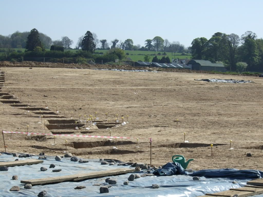
The massive site with the post holes marked in the foregound. More images of the exposed site

A description

The site is a large (c.80m diameter) circular enclosure formed of a double row or ring of stakeholes. The two rows are 2m apart. The stakeholes are small in diameter (c.10-15cm) and evenly spaced (c.60cm apart) perhaps suggesting post and wattle construction. The enclosure appears to have an entrance in the east. A smaller enclosure c.16m in diameter formed of similarly closely spaced postholes (c.25cm diameter) is positioned centrally within the large enclosure. There are two radial rows of postholes forming a corridor between the entrance of the outer and inner enclosures. In addition there are what appear to be two slot trenches between the end of the corridor and the entrance of the inner enclosure

The enclosure is situated at the centre of a natural geomorphological hollow surrounded by a ridge of higher ground which overlooks all sides of the monument, which in turn is surrounded by lower ground.

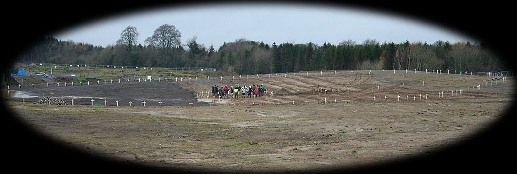
Anyway the last camp has been evicted from the area Tara Vigil Camp Being Evicted with some violence by the private security construction company and police. Further reports from the Tara Pixie.

More info on Lismullin.

Delicate site destroyed when NRA archaeologist removed all the top soil off it

M3/NRA reports. Inlcuding photos of the site before during processing(pdf). and Full report on Lismullin excavations with line drawings(pdf)(html copy)

Dept of Environment releases on Lismullin etc

It doesn't seem like(to my amateur eyes) they used a height map to show Lismullin's position in the hollow of the landscape does it?


Article on Lismullin by Joe Fenwick
On the Significance of Lismullin Archaeological Method and Theory and the M3 by Dr Ronald Hicks.


Comparison images from Sacred Ireland


M3 gets green light through Lismullin site

Wednesday, 7 November 2007

Rath Lugh monument finally on a map?

So finally there is a drawing of where Rath Lugh is from government survey done during the summer.

The map of Rath Lugh (PDF)

The blue line is the Rath and the red line is extended preservation zone.

Rath Lugh Temporary Preservation order.

Here is a plan of the motorway overlayed on the new map.

Here is the new map of Rath Lugh overlayed on an aerial photo of the strip examination.

In the second image above the motorway brushes the red line, the now extended preservation zone, but looking at the aerial photo from 2003/4 you can see that the road clearly transgresses the red circle to affect the blue circle outlining the Rath.

Apparently the NRA archaeologists acknowledge that the distance from the motorway has change but there is just confusion over this which you can read more of here. And here an earlier report from January when they first started to dig into the esker and move the boundary further towards Rath Lugh.

So what does it mean for the campaign to reroute the road? To me the motorway clearly transgresses the national monument. Previously they said it would 'skirt it'

instead it skirts the base of the elevated promontory on which Rath Lugh is located, approximately 20m below, and will not interfere with the site itself or the view of this site from Tara.

I note the the protection order is temporary and the government has given itself the power to destroy any national monument it wishes so we will see how John Gormley and Mary Deevy will use high standards of archaeological practice to destroy another ancient site.